• MONITORING
  • MAPPING
    • Home
    • About
      • Marine Environmental Monitoring
      • Our Team
      • News & Projects
      • Newsletters
      • Events
      • Sustainability and the Environment
      • Careers
      • Contact Us
    • Industries
      • Ports and Harbours
      • Bridges and Inland Waterways
      • Offshore Renewables
      • Maritime Pilotage
      • Installations
      • Customer Case Studies
      • Monitoring For the UK Hydrographic Office
      • Projects
    • Monitoring
      • Monitoring System Builder
      • Data Management and Display
      • Port-Log Data Platform
      • Consultancy and Advice
      • Design and Integration
      • Installations
      • Servicing and Maintenance
      • Environmental Conditions
    • Partners
    • Support
      • Resources
      • Support
      • Port-Log FAQs
      • Contact Us
banner
When you need to acquire, manage, use and share marine environmental data

When you need to acquire, manage, use and share marine environmental data

Enjoy the confidence of working with marine data experts

Learn More

When you need to acquire, manage, use and share marine environmental data

When you need to acquire, manage, use and share marine environmental data

Enjoy the confidence of working with marine data experts

Learn More

Ocean Wise News
  • Get in Touch
  • All Newsletters
  • Other News
  • Events
  • Unsubscribe

Further success for OceanWise Raster Charts XL

RCXL

The Royal Yachting Association (RYA) is the latest customer to take our Raster Charts Excluding Land (XL) product joining a prestigious list of marine industry organisations, such as Vattenfall, Qatar Petroleum, Scottish Government and the Department for Agriculture, Environment and Rural Affairs (DAERA) in Northern Ireland.

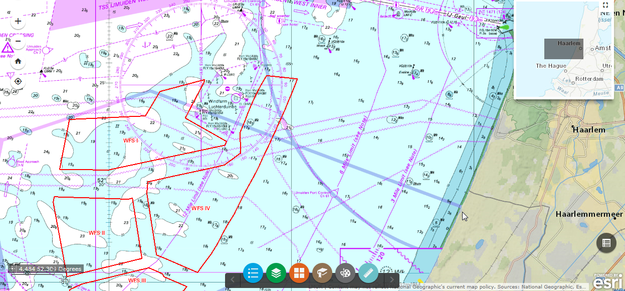
Based on the familiar nautical chart series, Raster Charts give contextual marine information dovetailed with terrestrial mapping to provide a rich background layer in support of Marine Planning. Raster Charts “XL” has had all land and land-based features removed, thereby allowing users to combine the marine raster data with a choice of more accurate, up-to-date and attractive land mapping data options. In addition, meta-features such as scale bars, source data diagrams and title blocks have been removed meaning they no longer hide more useful information.

The charts have also recently been extended to include the Arabian gulf. Raster Chart XL coverage now includes UK, France, Belgium, Netherlands, Germany, Denmark, Sweden and the newly released Arabian Gulf. This product extension forms part of OceanWise’ ongoing commitment to product development. Watch this space for further development!

Want to try it for yourself? Visit our demonstration site or download our sample data.

© OceanWise 2026. OceanWise Limited is an independent global company specialising in environmental monitoring solutions, marine mapping data and expert data management services.
Registrar of Companies of England and Wales No. 7206926.

Terms & Conditions | Privacy Notice | Contact Us

OceanWise HelpBot

Still need help?