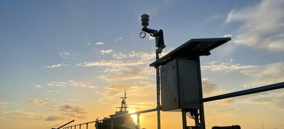
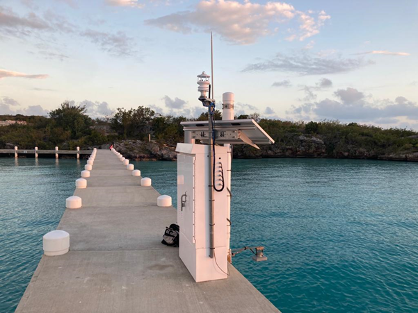
OceanWise were contracted by the UKHO under a 3-year framework agreement to install, operate and maintain a number of monitoring sites in various locations around the world. The framework includes provision of equipment, data management and a display platform, as well as local training and mentoring through community engagement.
Observational data collected at the sites is provided to local communities and global initiatives such as the Global Sea Level Observation System (GLOSS) and the IOC’s Sea Level Station Monitoring Facility, and is also used to refine tidal modelling and predictions. Additionally, all data collected is automatically analysed, processed and archived on a centralized and dedicated online server. Data is made available for the purposes of maritime and navigational safety, planning and situational awareness including assisting with ongoing programmes to update charts and associated navigational publications, and for Tsunami warnings as required.
To date, OceanWise have attended sites in a number of overseas locations including, Turks and Caicos, the Cayman Islands, Anguilla and Guyana. At each location, site surveys are carried out to establish the current state of existing sensors and infrastructure, alongside remedial work to reinstate existing sensors, the installation of new and improved technology to measure environmental parameters and telemetry systems for the transfer and sharing of data.
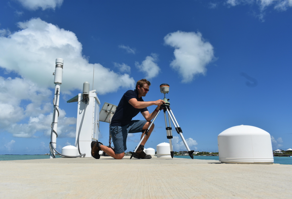
Sites such as those on Anguilla and Montserrat required new full MEMS installations. This involves a standard suite of sensors which include met stations, tide gauges and telemetry equipment tailored to meet the specific requirements of the user and the given locality. Where required, our team of engineers undertake Global Navigation Satellite Systems (GNSS) surveys to establish geodetic marks for tide gauge levelling and establishing a local datum.
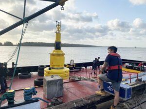
In addition to onshore MEMS installations, OceanWise have also deployed a GNSS tide buoy and profiler on behalf of the UKHO to collect tidal height and stream data offshore of Guyana. The purpose and requirement of this data is to accurately assess both tidal characteristics and spheroidal separation for the area. The buoy will collect data for a minimum of 30 days, following which the data will be processed by the UKHO’s Tide Department to establish Chart Datum for the area. Once this part of the project is completed the buoy with be reconfigured with additional sensors such as a met station, and redeployed on a long-term basis as a metocean data buoy with data being stored and displayed within the UKHO’s Port-Log.
A major part of the framework agreement is the provision of an online data platform to host, visualise, store, and facilitate the sharing of environmental data. OceanWise’s Port-Log provides the ideal platform to facilitate this.
Port-Log is used by a range of customers across the globe and is a quick and easy management and publishing platform for environmental data. Being a cloud-based data platform, it enables data to be stored securely and published in near real-time via the web, as well as maintaining long-term historical records. Within Port-Log the user can view geographic distribution as well as tabular data feeds from each site as seen here below. The 'Latest' page shows a list of the most recently received data from all sites and sensors on the network and, where available. incorporates tidal predictions to calculate surge or cut values.
To ensure this table always shows the most up to date and reliable data there are several indicators and Quality Control and Assurance factors built into the system to warn of a decrease in data validity. The indicators operate using a simple colour coded warning system which helps to give the user confidence (or not) in the data and to treat it accordingly. Alerts are also displayed and the user can click through to view the received error message to assist with fault finding and resolution.
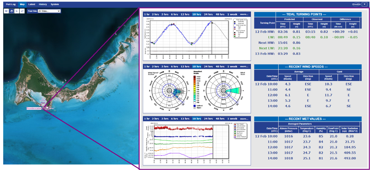
The dissemination of data to all users who require it is at the forefront of how Port-Log operates and therefore the platform can be viewed through a web-browser on any device. There is also the ability to integrate with third-party systems such as dredge management software or Portable Pilot Units. Of course, it is not only the real-time data that is important, historical data and long-term records are also significant and good management of these datasets is vital for decision making and coastal resilience.
All data collected can be accessed for each site, along with associated statistics and graphs, such as time series, all of which are customizable to the records you are interested in. Data can also be in numerous formats for analysis in other software environments.
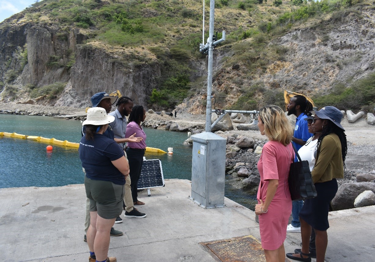
Education and awareness ensure communities and local users understand the purpose of the environmental monitoring equipment and potential impacts of it being out of action.
Whilst installing equipment and carrying out required maintenance and improvements to existing infrastructure, our team of engineers have provided onsite training to local organisations and users which covers both the setup of the equipment and the importance of regular maintenance to ensure accurate and reliable data continues to be received. Good maintenance of equipment helps prolong the longevity of the sensors and extend the asset lifespan; of great importance when trying to stretch limited budgets!
An example of this is the training provided to Montserrat Port Authority to ensure users got the most out of the system and its data. This training prompted discussions which led to changes to their Hurricane Preparation Plan, which OceanWise assisted with by marking cables with green and red tags to help with the removal of the met mast in preparation for a storm event – red cables should be removed, green should remain in place.
OceanWise were contracted by the UKHO under a 3-year framework agreement to install, operate and maintain a number of monitoring sites in various locations around the world. The framework includes provision of equipment, data management and a display platform, as well as local training and mentoring through community engagement.
Observational data collected at the sites is provided to local communities and global initiatives such as the Global Sea Level Observation System (GLOSS) and the IOC’s Sea Level Station Monitoring Facility, and is also used to refine tidal modelling and predictions. Additionally, all data collected is automatically analysed, processed and archived on a centralized and dedicated online server. Data is made available for the purposes of maritime and navigational safety, planning and situational awareness including assisting with ongoing programmes to update charts and associated navigational publications, and for Tsunami warnings as required.
To date, OceanWise have attended sites in a number of overseas locations including, Turks and Caicos, the Cayman Islands, Anguilla and Guyana. At each location, site surveys are carried out to establish the current state of existing sensors and infrastructure, alongside remedial work to reinstate existing sensors, the installation of new and improved technology to measure environmental parameters and telemetry systems for the transfer and sharing of data.
Sites such as those on Anguilla and Montserrat required new full MEMS installations. This involves a standard suite of sensors which include met stations, tide gauges and telemetry equipment tailored to meet the specific requirements of the user and the given locality. Where required, our team of engineers undertake Global Navigation Satellite Systems (GNSS) surveys to establish geodetic marks for tide gauge levelling and establishing a local datum.
In addition to onshore MEMS installations, OceanWise have also deployed a GNSS tide buoy and profiler on behalf of the UKHO to collect tidal height and stream data offshore of Guyana. The purpose and requirement of this data is to accurately assess both tidal characteristics and spheroidal separation for the area. The buoy will collect data for a minimum of 30 days, following which the data will be processed by the UKHO’s Tide Department to establish Chart Datum for the area. Once this part of the project is completed the buoy with be reconfigured with additional sensors such as a met station, and redeployed on a long-term basis as a metocean data buoy with data being stored and displayed within the UKHO’s Port-Log.
A major part of the framework agreement is the provision of an online data platform to host, visualise, store, and facilitate the sharing of environmental data. OceanWise’s Port-Log provides the ideal platform to facilitate this.
Port-Log is used by a range of customers across the globe and is a quick and easy management and publishing platform for environmental data. Being a cloud-based data platform, it enables data to be stored securely and published in near real-time via the web, as well as maintaining long-term historical records. Within Port-Log the user can view geographic distribution as well as tabular data feeds from each site as seen here below. The 'Latest' page shows a list of the most recently received data from all sites and sensors on the network and, where available. incorporates tidal predictions to calculate surge or cut values.
To ensure this table always shows the most up to date and reliable data there are several indicators and Quality Control and Assurance factors built into the system to warn of a decrease in data validity. The indicators operate using a simple colour coded warning system which helps to give the user confidence (or not) in the data and to treat it accordingly. Alerts are also displayed and the user can click through to view the received error message to assist with fault finding and resolution.
The dissemination of data to all users who require it is at the forefront of how Port-Log operates and therefore the platform can be viewed through a web-browser on any device. There is also the ability to integrate with third-party systems such as dredge management software or Portable Pilot Units. Of course, it is not only the real-time data that is important, historical data and long-term records are also significant and good management of these datasets is vital for decision making and coastal resilience.
All data collected can be accessed for each site, along with associated statistics and graphs, such as time series, all of which are customizable to the records you are interested in. Data can also be in numerous formats for analysis in other software environments.
Education and awareness ensure communities and local users understand the purpose of the environmental monitoring equipment and potential impacts of it being out of action.
Whilst installing equipment and carrying out required maintenance and improvements to existing infrastructure, our team of engineers have provided onsite training to local organisations and users which covers both the setup of the equipment and the importance of regular maintenance to ensure accurate and reliable data continues to be received. Good maintenance of equipment helps prolong the longevity of the sensors and extend the asset lifespan; of great importance when trying to stretch limited budgets!
An example of this is the training provided to Montserrat Port Authority to ensure users got the most out of the system and its data. This training prompted discussions which led to changes to their Hurricane Preparation Plan, which OceanWise assisted with by marking cables with green and red tags to help with the removal of the met mast in preparation for a storm event – red cables should be removed, green should remain in place.
With OceanWise’s help we sorted everything out and have ended up in a good place with reliability issues sorted as a bonus
Provision of accurate tide and weather data underpins our services not only to commercial traffic but also to UK leisure sailors as well. The OceanWise Port-Log system ensures we are able to continue to do that long into the future.
Great work, the work that you have done is exactly what our SLA was supposed to deliver with a proactive approach
© 2026 OceanWise. All rights reserved.